Tuesday, May 27, 2014

Day 40: Great Western Adventure

Day 40: Thursday, May 22nd
Where we divide and go separate ways
Zion to Las Vegas, NV via Hoover Dam

Distance: 155 miles; Time: 2:20
Route Taken: Hwy 9 south to I-15 south into Nevada. Detour onto hwy 95/93 south to Boulder City, NV. Look for the signs for Hoover Dam. Then retrace our path back north to Las Vegas Blvd. and The Palazzo. 

From here our group split into two groups. Mike, Adam and I drove to Las Vegas, NV., where as Mom, Dad, and Natalie took the RV and headed toward Green River, UT along I-70. Once we have reunited in a few days, I'll post their pictures. Until then, I'll post pictures of our trip to Las Vegas and surrounding area.


The drive south on I-15 from UT into NV was interesting. The interstate cut a path right through the mountains. 


Still following the Virgin River as it cut its path through the mountains to join the Colorado River at Lake Mead and then through Hoover Dam.


I couldn't believe the crowd at Hoover Dam. We found the parking garage just about full, having to park on the top floor. Lots of tour groups were gathered at the gift shop and food court. 
We tried to get tickets for the whole tour, but the wait was 3 hours long. So, instead we took the 1/2 hour power plant tour, which was still very interesting.


Had to hang onto our hats here. The wind was blowing hard.


The bypass.


My favorite guys.


A view of Lake Mead sitting about 70 ft. below normal levels.


Our view from the Palazzo from our room on the 40th floor.


Lots of folks milling around the pools this evening.
Special dinner extravaganza going on below. Tickets only for $105.00.
We opted to walk around the Grand Canal shops and buy a cannoli from Carlos Bakery.
Yummy.


Beautiful fountains.


Beautiful sunset.


Monday, May 26, 2014

Day 39: Grand Western Adventure

Day 39: Wednesday, May 21st
Observation Point and East Rim Trail @ Zion National Park


A little tamer than yesterday, we drove out toward the east gate of Zion National Park today and took 2 short hikes as a family. Adam seemed to be feeling better today, so he came along as well.


These were the views from the road.
Amazing.


To get to Observation Point, you take hwy 9 east through the park. Just as you exit the 1 mile tunnel on the east side, we looked for the parking lot on the right. The trail head was on the opposite side of the road from the parking lot. 


The trail was short, but the first section was rather steep. It had handrails and foot holds cut into the path.


This was a rather surprising part. 


I loved the lines in the sandstone here.


At least they put handrails here.


The view at the end of the trail was this! Awesome. 
You could see the whole valley from this point. 

End of the trail.


Observation Point Canyon Overlook.


So yesterday, we hiked a short distance along the West Rim Trail and today, we tackled a few miles on the East Rim Trail. 


Looking back along the trail route where we came from. The trail really picked up some elevation.


The trail was so very sandy. Felt like we were hiking on the beach.


The views from the top. From here the trail went down and around the valley to the other side. 
This was as far as we decided to go. It was time to head back to town and meet up with Mom and Dad for supper.


The total distance ended up being 6 miles anyway, which was fine with us. 


Look at this. Fascinating, isn't it? 


Back on the road again, we stopped to see the Checkerboard Mesa. Love it!


Back through the tunnel and down the road, we stopped at a pullout to look up at Observation Point. 
We stood on top just a few hours before.


Once we returned to the RV, we met up with Mom and Dad and drove into Springdale for a late lunch/early supper. Our favorite place to eat in Zion area is Pizza & Noodle Co. 
Excellent pizza. 


Sunday, May 25, 2014

Day 38: Grand Western Adventure

Day 38: Tuesday, May 20th
Angels Landing Hike


Another fantastic (and frightening) hike in Zion. 
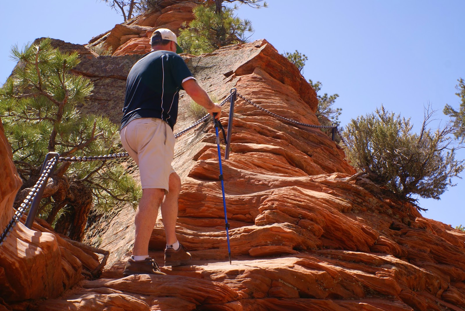
For this hike, you take the West Rim Trail up to Scouts Landing where the trails diverge. The remaining 1.1 mile trail up to Angels Landing is extreme.

We weren't even close to the end of the trail and you can see how high up we were. Down by Natalie's left arm was the main road.


This was where the trail went CRAZY!!
The remaining .5 miles of Angels Landing looked like this and much more extreme.


The trail went up an extremely narrow spine of the mountain.


The view into the valley.


The remainder of the trail.
If you look closely, you can see hikers along the trail. Like little ants moving up and down the pass.


This trail was insane.
 This was as far as I could take myself.


Natalie went a little further ahead to snap these views of the valley and the end of the trail.


There were a few chain link railings for safety, but nothing about this trail was safe. The drop offs were sheer cliffs on both side, and there was no safe place anywhere. Any fall would be fatal.


See how close the railings and trail were to the edge?


Another view of the valley from the trail.


So, not only was the trail dangerously close to the cliff edge, you had other hikers passing you going back down the trail as you were trying to go up!
Passing each other on the side of a cliff, with only a few railings!!


This really was how wide the trail was. Very narrow. Possibly 4 to 5 feet width.


Sheer drop off on either side. 1,400 feet below to the valley floor.


I may be smiling for the camera, but you can't see how much my hands were sweating and my legs were shaking here.
The wind was wicked too. I felt like I was being blown off the mountain.


Natalie on the other hand was completely in her element. She loved it.


I'm climbing back down the trail and the wind is blowing me back up.


This was where I was climbing down to.
I had to wait for others to pass going up so I could make it back down this section.
This part was rock that had hand and foot holds cut into the rockface.
I never felt like my boots were going to slip on the rocks, but I also didn't feel safe or secure with the wind blowing at us. The backpack made me feel very unbalanced and the hiking poles were no use on the solid rock.


Again, the view from the trail.


Once we found a resting place, Natalie found a friend who was very interested in our backpack. 


This was our stopping place, called Scouts Lookout, where we had a snack and I recovered.


From here, we decided to check out a few miles on the West Rim Trail. There were spectacular views from here, without the dangers of the sheer cliff edges.
My kind of trail.
The West Rim Trail wanders in a northwest direction about 15 or so miles. We just wanted to see what was at the top. Then we turned back and logged about 6 miles total.


Another view of Angels Landing with the top in the far left corner.


Heading back down the trail.


Looking back toward the West Rim Trail.


Some wicked switchbacks to get back down to the river and the main road.


This sign reported that 6 people have fallen to their deaths while hiking Angels Landing. About 1,400 ft. 
That's sobering and terrifying.
Not on my bucket list anymore.