Showing posts with label Rivers. Show all posts

Wednesday, October 3, 2012

Day 35: How we floated down the Colorado River


Colorado River Float Trip

Glen Canyon Dam to Lee's Ferry
We signed up for the Colorado River Float Trip. It was not a white water trip. It was a leisurely float down 15 miles of the Colorado River from the Glen Canyon Dam access to Lee's Ferry. 

It was beautiful.


You should have seen Nana going down the 2 mile tunnel access to get to the bottom of the Glen Canyon Dam, where the boats were located. 

She had her eyes closed.

We took a tour bus from the parking lot of the Colorado River Rafting Co. to the tunnel access rd. It was a steep 6% grade downhill in the dark. Like a roller coaster. Except in slow motion.
Every 500 feet there were side tunnels that entered the canyon walls. 
Pretty amazing. 
When they were constructing this tunnel access, they had 2 groups working on it 24 hours per day. One group at the top, while the other group worked from the bottom and were lowered down with ropes. Instead of hauling all the debris to the top, they built these side tunnels and dumped the dirt and rocks out the side. 
We counted 18.

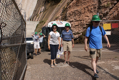
Here's Nana and Paw. She looks relieved to be out of the tunnel. 


We're settled into our raft. It has a motor, so now oars.


Here's a look down the canyon.


Here's a look back at the Dam.


The happy couple with Adam in the background.
He was pretty happy. He met a friend, from Kentucky, who was out on fall break. They hung out together the whole time.


The sides of the canyon.


Natalie looking happy too.


Our only white rapids. Class .05!
Meaning not much there.


The black sides of the canyon are called desert varnish. It's the oldest part that has been baked in the sun. The newer parts are more tan colored. 


Day 34: Page, AZ

Upper Antelope Slot Canyon,
Glen Dam Tour &
Horseshoe Bend 

We started our day off with a Navajo led tour of the Upper Antelope Slot Canyon. Our tour guide, Ronda, talked to us about the local history, geology, and Navajo Culture. 


The slot canyon was extremely beautiful with varied colors of reds.


The light was just coming in through the top.


Although, not apparent in the pictures, it was very crowded. There were 4 different Navajo tour groups operating tours through this Canyon, and our group had about 20 total. In some areas, it was standing room only.


Adam liked our tour group leader and he stuck with her through most of the tour. She took his camera and made several unique shots for him.


We signed up for a tour of the Glen Canyon Dam too in the afternoon. Earlier, we had visited the Visitor's Center and Adam picked up another Jr. Ranger booklet to complete, and we noted they had tours. 

Our tour guide, another Navajo, spoke of many facts and figures concerning the water flow and height and building process, but I can't remember any of them tonight. 


It's still impressive anyway.

Nana, who doesn't like elevators, had to descend in two of them for this tour. She's not too happy with me.


A view from the top of the Dam. 


Still later in the evening, Natalie and I took a short hike/walk up to Horseshoe Bend. It was a wide sandy stroll up and then down a long hill to the edge of the cliff. 


That's about as close as I felt comfortable getting. 


You can see others, didn't have any common sense though.


I made Natalie stand way back from the edge. 
She's a bit fearless.


The sun is going down on us. 


A pretty desert flower/weed.


Sunset over the buttes/mesas, whatever.
 I don't know what to call them.


Monday, October 1, 2012

Day 32: Zion National Park

Zion National Park

We took the shuttle into the park this morning. Adam picked up another Junior Ranger booklet, so he was a happy hiker today as well.


We took in another Ranger talk. This time about the early history of the park. How they made the one mile tunnel and what the early tourists encountered when they arrived.

Then, we went on the shuttle up to the furthest point and got off. It happened to be the Temple of Sunwava. There was a nice riverwalk stroll that we took along with everyone else was happened to be visiting Zion today. It was crowded. 
We learned about 3 million people visit Zion each year. I can see why.


The walk was about 2 miles round trip. Not too bad for us. It was a paced path with very little incline. 


The Virgin River


At the end, some people continue hiking into the Narrows, which crosses the river and up the narrow canyon.


We chose to eat our lunch and watch them....


Afterwards, we took the shuttle back down and stopped at various points called, The Grotto, Weeping Wall, and Zion Lodge.

Adam had to find out all sorts of interesting facts, such as whose face is engraved in the plaque at the Museum Center? 
Stephen Mather.

What type of tree is in front of the Zion Lodge?
Cottonwood.

Who were the Court of the Patriachs named after?
Abraham, Isaac and Jacob.

We also took another short trail at the Zion Lodge called the Lower Emerald Pools Trail. It was about a mile long. We saw all sorts of creatures. tarantulas, deer, lizards, and squirrels. 


  Natalie and Adam have been taking many of today's pictures. 

Then we took the shuttle back to the visitor's center so Adam could be sworn in as a JR. Ranger.
Another happy boy. 

We ordered take out pizza. 
All are tired and need some rest. 

Friday, September 28, 2012

Day 28 & Day 29

Day 28
West Glacier, MT to Dillon, MT

Total Miles:300
Total Distance: 3,820

Our Route:

We set out of West Glacier heading back toward Columbia Heights on hwy 2.  We took a scenic hwy 206 for a few miles to hwy 35. Hwy 35 was said to be very scenic as well. 
A two lane road that runs beside by Flathead Lake. It was smoky from all the wildfires, but still very interesting. 


Near Polson, MT, we picked up hwy 93 again heading south. Just west of Missoula, MT, we found I-90.


We passed through Deer Lodge and Butte, where we then picked up I-15.


We stayed at Southside RV Park in Dillon, MT. The lady at the office was just as nice as she could be. She was so talkative and friendly too. 

She told us she was a history buff and loved to research family histories through DAR. She even looked up things up for the Crisp Family Name and brought the information to us. 

She gave Adam a ride on her 4-wheeler. He was so pleased. 

 The sunset tonight was especially lovely. 


Day 29
Dillon, MT to Ogden, UT

Total Miles: 320
Total Distance: 4,140

Our Route:

We took I-15 all the way south through the southern part of MT, all the way through Idaho and into UT.

We passed over the Snake River, which we remember taking a float trip down when we visited the Tetons a few years ago. 

Then Paw got out the map and he traced it all the way from the Tetons to where we were on I-15. 
Pretty neat. Maybe you should too?


For lunch, we stopped at a road side rest stop. I was thinking, we could eat a quick bite for lunch and let us all get out to stretch out legs and then be back on the road again.
Well, 


I didn't know we had stopped at such an interesting place. We had to check it out...


The lava flowed out of giant fissures in the earth's crust. Not from a volcano. It oozed out and then cooled quickly on the top forming a crust. 


The lava flow is called Pahoehoe.


This area is also called a "high desert". There are sage brush growing here.


A one mile nature walk


We had to explore it.


Juniper berries.


After our delay, we made it to Utah!!


The mountains of Utah


Even this area has seen lots of smoke from the Idaho wildfires. Not so bad this week though, we were told.


The mountains here have red in them. Don't know what kind of trees they are, but they are quite beautiful. We are used to the yellow Quaking Aspens from the northern states and Canada. 


Our campground tonight is in Ogden, UT. It's next to the interstate, but has a heated pool and hot tub. We are excited to relax in it before supper. 

Tomorrow, another long drive down to Bryce Canyon.